
 Sale!
Sale! Hema Map Outback New South Wales – 5th Edition on Waterproof Paper
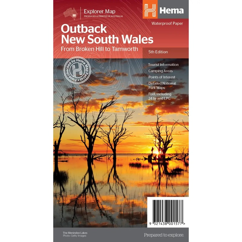
A regional map of outback NSW (1:1,100,000) that ranges from Tamworth in the east to Broken Hill in the west, as well as from Wagga Wagga in the south to past the Queensland border in the north. On the opposite side is extensive information on numerous reg
$9.99
-
$7.99
 100% Happiness Backed or Your Money Back
- Spend 30, Ship Free
- Love It or Return It Within 60 Days
Details
A regional map of outback NSW (1:1,100,000) that ranges from Tamworth in the east to Broken Hill in the west, as well as from Wagga Wagga in the south to past the Queensland border in the north. On the opposite side is extensive information on numerous regions, including visitor, historical and background information. Covered regions include the Broken Hill region, Corner Country, east of Tibooburra, the White Cliffs region, Cobar and surrounds, around Back o’Bourke, Lightning ridge and surrounds, Wentworth region, Balranald, Griffith region, Dubbo and surrounds, Kinchega National Park, Mungo National Park, Sturt National Park and Mutawintji National Park.
Features:
- Detailed National Park Maps
- Tourist information
- Camping areas
- Points of interest
- Waterproof paper
- Unfolded Size (WxH)1000 x 700 mm
- Cover Size (WxHxD)140 x 250 x 3 mm
##ATTRIBUTEDETAILS[groupid=3]####ATTRIBUTEDETAILS[groupid=9]##
Shipping Info
- Cost: $25
- Free Shipping
- We offer free shipping on orders over $30. Please check the free - shipping eligibility at checkout.
- Delivery Time:
- It usually takes [3-5] business days for standard shipping. Please note that this is an estimated time frame and may be affected by local holidays, and unforeseen circumstances.
Related products


Reviews
There are no reviews yet.