
 Sale!
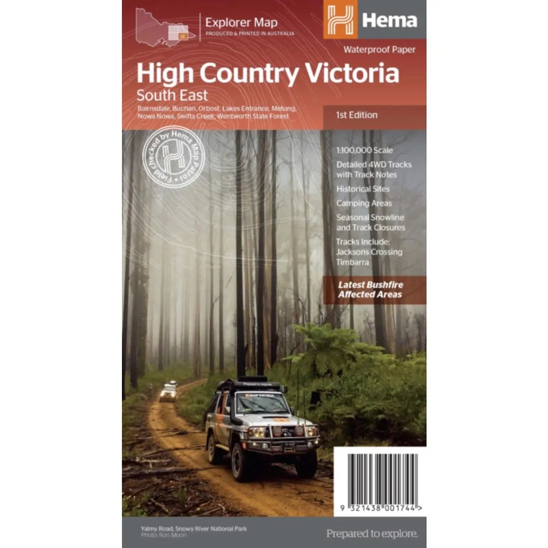
Sale! Hema Map High Country Victoria (South East) – 1st Edition
This map is part of Hema's new Victorian High Country Map Series and covers the Southern Lowlands and Lakes Areas including Gippsland and Snowy River National Park. Printed on durable waterproof paper, this map features Hema's iconic mapping and extensive
$9.99
-
$7.99
 100% Happiness Backed or Your Money Back
- Spend 30, Ship Free
- Love It or Return It Within 60 Days
Details
This map is part of Hema’s new Victorian High Country Map Series and covers the Southern Lowlands and Lakes Areas including Gippsland and Snowy River National Park. Printed on durable waterproof paper, this map features Hema’s iconic mapping and extensive points of interest. Featuring roads and 4WD tracks field-checked by the Hema Map Patrol for superior accuracy.
It combines Hemas entire database of roads and 4WD tracks with touring points of interest and topographic information. Also included are seasonal track closures, camping areas, old townsites, huts, accommodation and distances.
Key features:
- 4WD tracks
- Huts
- Camping areas
- Old townsites
- Seasonal track closures
- Road distances
- Accommodation
- Cover Size: 25 x 14 x 0.3 cm
- Unfolded Size: 100 x 70 cm
- Scale – 1 : 1000,000
##ATTRIBUTEDETAILS[groupid=3]####ATTRIBUTEDETAILS[groupid=9]##
Shipping Info
- Cost: $25
- Free Shipping
- We offer free shipping on orders over $30. Please check the free - shipping eligibility at checkout.
- Delivery Time:
- It usually takes [3-5] business days for standard shipping. Please note that this is an estimated time frame and may be affected by local holidays, and unforeseen circumstances.
Related products


Reviews
There are no reviews yet.